Navigate the atlas using functions
This section refers to a graphical user interface that appears as a base map. On this map spatial and thematic navigation is possible. To achieve this, several buttons - the so called "tools" - are provided, which will be explained in the following section.
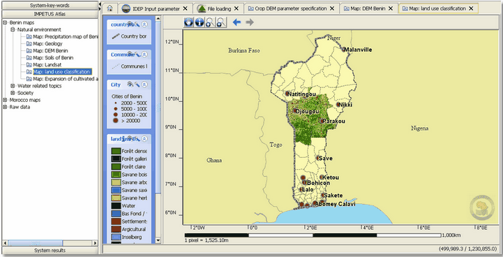
The map field already encompasses the graphical treatment of the parameters. In this preceding step the data is transformed into geographical (location) characteristics in order to support local decisions in a visual way. The notes on the left and at the bottom edge of the map indicate the coordinates of the map extract.
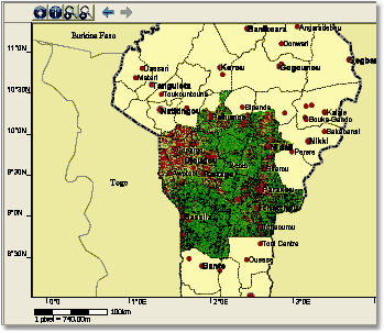
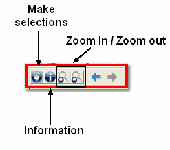
Using the four navigation elements the user can navigate within the map. The user is provided with four symbols. To zoom in/out click on the corresponding symbols ![]()
![]() . Then draw the black frame (1.) over the desired extract (see figure below). In the next step the extract appears in the new scale in map field (2.).
. Then draw the black frame (1.) over the desired extract (see figure below). In the next step the extract appears in the new scale in map field (2.).

Using the zoom-in function
• Information
![]() This button provides the user with access to further information, which is not graphically displayed. To use this function, click on the button and choose a bas-fond (for example SDSS BenIVIS) on the map. A new tab is opened in the browser containing information about the location, physical characteristics and socio economic importance for the residents.
This button provides the user with access to further information, which is not graphically displayed. To use this function, click on the button and choose a bas-fond (for example SDSS BenIVIS) on the map. A new tab is opened in the browser containing information about the location, physical characteristics and socio economic importance for the residents.

Information document for a bas- fond
On the left hand side of the map a list consisting of the different layers (key words) is shown. The layers can be hidden or displayed. In addition, the user can use the filterfunction to filter the data and display a selected list of attributes.
• Tools II
The eye symbol ![]()
![]() enables to display or hide the layer in the map field. In this way the overview can be navigated.
enables to display or hide the layer in the map field. In this way the overview can be navigated.
The symbol on the outward right side ![]() serves to hide the key words in the overview but does not have any impact on the map content.
serves to hide the key words in the overview but does not have any impact on the map content.
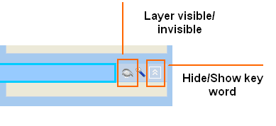
Further tools ![]() marked with this symbol provide a further choice of the parameters to be displayed. They can be managed using thefilterfunction.
marked with this symbol provide a further choice of the parameters to be displayed. They can be managed using thefilterfunction.
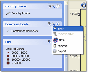
With this function you can make a choice of the given data. Therefore the dialogue window shown below is opened. The filter characteristics are determined by entering attributes, an arithmetic formula and operators (AND/OR/NOT).

Here: filter function: show/hide <rivers>