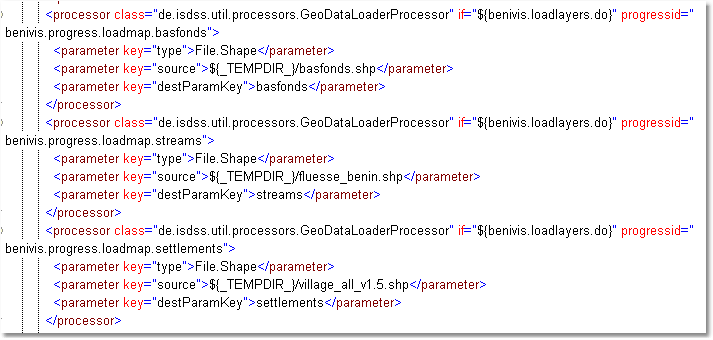
Parameter
class = de.isdss.util.processors.GeoDataLoaderProcessor
This processor is based on Geotools and loads a geo data object (GridCoverage2D or FeatureCollection) into memory. In order that the ATLAS (display styles and legends) visualisation can also deal with the objects, the processor does not store the Geotools objects directly in the out parameters, but encapsulated in a styled geo object (StyledFeatureCollection, StyledGridCoverage).
Required input parameters:
•Key type: type of input data
Supported values:
•File.ArcInfoAscii
•File.GeoTiff
•File.GeoTiff.Reader
•File.Shape
•Key source: source of input
Supported values depend on type:
•type File.xxx: path to input file(s)
•Key destParamKey: Output parameter key where the data is stored in
•Key defaultCRS (optional): WKT-specification or EPSG-code of the coordinate reference system, which is be used in case of importing non-projected data.
•Key style (optional): Name of the style, defined in the ISDSS configuration, used to style the map. If not given, the style is tried to be read from .sld- and .amd/.rld-files